I am working on creating a facebook fan page for a club I am a member of, the Outdoor Adventure Social Club of Charlottesville, VA. Here I am experimenting with the badge function.
Thursday, December 17, 2009
Monday, November 16, 2009
Via Ferrata, West Virginia Style
Last Saturday Tom and I went rock climbing "Via Ferrata" at Nelson Rocks, West Virginia. It's and "iron road" over the rocks using steel cables and rungs, plus a really cool suspension bridge. We both had a great time and finished the entire course. Tom is a natural at rock climbing (he we went to a gym a few weeks ago and really liked it), and had no problem with heights. For me it took about 5 rungs to get the hang of it but I never really felt comfortable, but that's ok because it was an adrenalin rush the whole time. I don't understand why we humans like to put ourselves into these crazy unnecessary situations, but it must have something to do with the brain chemicals.
 |
| From Via Ferrata |
 |
| From Via Ferrata |
See the whole album:
|

Wednesday, November 11, 2009
Hiking Training Progress Report
We have about 100 days until the trip and have been working hard at improving my stamina for long distance hiking. In the past 3 months we have hiked about 120 miles, with about 32,600 feet of elevation up and down over 10 day hikes and two backpacking trips. When I first started, my average day hike speed was 1.4 mph, and now I average 2 mph. I have been keeping track of everything using my GPS.
I have lost 10 pounds and gained a lot of muscle. Hiking is more enjoyable and I feel more confident and less clumsy. But I still have a ways to go with overall speed, especially with a pack. I have to get up to 2.5 mph to match the leader's low speed.
I have lost 10 pounds and gained a lot of muscle. Hiking is more enjoyable and I feel more confident and less clumsy. But I still have a ways to go with overall speed, especially with a pack. I have to get up to 2.5 mph to match the leader's low speed.
Sunday, November 8, 2009
did you fall in?
Tom and I spent the weekend backpacking at Ramsey's Draft Wilderness Area in the George Washington National Forest. We went with our friend Keith from the club whom we have backpack with before and is very experienced. John from Blue Ridge Mountain Sports gave me inspiration and advice for the trip after others had told me it was too difficult and easy to get lost.
The first day of the trip was much different than your average hike. We followed the river and crossed it many times. The area is designated "Wilderness" so no trail blazes are allowed, and no trail maintenance is performed. That means if a 4-foot-diameter tree falls across the path, you have to climb over/under it, or hike around it, which is not easy on a steep slope with a 30-pound pack. In a few spots we lost the trail, but quickly found it again. As long as we took our time we were ok. We had to trust our instincts-if you feel like you are off the trail, you probably are, so stop and look around.
The river crossings were not too bad in most places, but in one spot the rocks were slippery and I fell in, soaking both boots. I stopped and rung out my socks and kept going without too much trouble.
The area along the river once had many giant hemlocks, but they were all recently killed by disease. Hence the reason for many of the roadblocks. One fell across a particularly deep and fast portion of river and made an excellent bridge.
There were a lot of saplings on the trail whipping in our face as we walked through them. It made us very appreciative of the regular trail maintenance performed by groups like the PATC.
The final push up Ramsey's Draft to Hiner Spring was difficult and steep. By the end of the first day our feet and backs were very tired but we felt well accomplished. We hiked only 7 miles in 5 hours, but we did not get lost and no one got hurt. The camp site was lovely with plenty of flat spots and camp fire wood. The spring was nearby and we had plenty of time to set up and cook dinner before dark. Just after dark, several deer came and visited us within 20 feet of the campfire. We went to sleep around 7:30pm.
My best guess to the overnight low was 40 degrees--not bad for November. My feet got a little cold (with dry socks) I think because they were on the ground off my sleeping pad (the spot was sloped down slightly and I kept sliding). Otherwise we were warm in our tents and slept well.
The second day was much more like a standard Shenandoah mountain hike. It was longer - 9 miles - but mostly down hill on well marked trails. The weather was 70 and sunny with a slight breeze. We saw many old pines and oaks and hiked in leaves knee-deep in places. Many of the ridge paths were slanted, making us appreciate trail maintenance again. We averaged 2 mph with stops, a pretty good pace with packs.
Overall I had a great time hiking and camping this weekend. My body hurt less than last time (see Dolly Sods) and I had an easier time keeping up with Tom and Keith. While hiking I asked myself "why do you like backpack so much when it hurts so much?" They answer is that I enjoy the adventure getting there, sleeping in the wilderness, and knowing that I have everything I need to survive for two days on my back, and spending quality time with my hubby and friends. So the goal is to keep getting into shape to make getting there more enjoyable.
Birds seen on the trip: downy woodpecker, hairy woodpecker, junco, nuthatch, titmouse.
The first day of the trip was much different than your average hike. We followed the river and crossed it many times. The area is designated "Wilderness" so no trail blazes are allowed, and no trail maintenance is performed. That means if a 4-foot-diameter tree falls across the path, you have to climb over/under it, or hike around it, which is not easy on a steep slope with a 30-pound pack. In a few spots we lost the trail, but quickly found it again. As long as we took our time we were ok. We had to trust our instincts-if you feel like you are off the trail, you probably are, so stop and look around.
 |
| From Ramsey's Draft |
The river crossings were not too bad in most places, but in one spot the rocks were slippery and I fell in, soaking both boots. I stopped and rung out my socks and kept going without too much trouble.
The area along the river once had many giant hemlocks, but they were all recently killed by disease. Hence the reason for many of the roadblocks. One fell across a particularly deep and fast portion of river and made an excellent bridge.
There were a lot of saplings on the trail whipping in our face as we walked through them. It made us very appreciative of the regular trail maintenance performed by groups like the PATC.
The final push up Ramsey's Draft to Hiner Spring was difficult and steep. By the end of the first day our feet and backs were very tired but we felt well accomplished. We hiked only 7 miles in 5 hours, but we did not get lost and no one got hurt. The camp site was lovely with plenty of flat spots and camp fire wood. The spring was nearby and we had plenty of time to set up and cook dinner before dark. Just after dark, several deer came and visited us within 20 feet of the campfire. We went to sleep around 7:30pm.
My best guess to the overnight low was 40 degrees--not bad for November. My feet got a little cold (with dry socks) I think because they were on the ground off my sleeping pad (the spot was sloped down slightly and I kept sliding). Otherwise we were warm in our tents and slept well.
The second day was much more like a standard Shenandoah mountain hike. It was longer - 9 miles - but mostly down hill on well marked trails. The weather was 70 and sunny with a slight breeze. We saw many old pines and oaks and hiked in leaves knee-deep in places. Many of the ridge paths were slanted, making us appreciate trail maintenance again. We averaged 2 mph with stops, a pretty good pace with packs.
 |
| From Ramsey's Draft |
Overall I had a great time hiking and camping this weekend. My body hurt less than last time (see Dolly Sods) and I had an easier time keeping up with Tom and Keith. While hiking I asked myself "why do you like backpack so much when it hurts so much?" They answer is that I enjoy the adventure getting there, sleeping in the wilderness, and knowing that I have everything I need to survive for two days on my back, and spending quality time with my hubby and friends. So the goal is to keep getting into shape to make getting there more enjoyable.
 |
| From Ramsey's Draft |
Birds seen on the trip: downy woodpecker, hairy woodpecker, junco, nuthatch, titmouse.
Monday, November 2, 2009
Job Suff
Some of you might know that I work part time as a mechanical design engineer. My hours have varied from 20 to 30 hours per week for the last year and a half, depending on the work load. I use a 3-D Computer Aided Design software called SolidWorks to make 'virtual' electro-mechanical devices. Being married and working part time has really improved my quality of life. Before, I worked 40-50 hours per week and commuted 45 minutes each way. I enjoyed my work but I was always exhausted and spent the weekend recovering. Sure, I get paid half as much, but my job is just a fulfilling and I feel as if I get just as much done. And now I have a social life, personal life, and even a gym life, all while getting 9-10 hours of sleep every night.
I am experiencing my first recession since graduation, while working for my first private company. The nation-wide situation did not hit home for me until February when they laid off more than half the people. On Friday my company laid off another two people and reduced the hours of many more. I was reduced to 8 hours per week, with the possibility of working more depending on the workload. I feel lucky to still have a job, and until now I was immune to reductions because engineering has been working really hard to roll out a new product. But things are on hold now for me during emi and ul testing. (I am really worried that work will pick back up in time for our n.z. trip)
After my boss broke the news to me, he gave me some positive feedback on my job performance. I responded with positive things about my job and the company, and my value to the company to be flexible when work is needed.
I am trying to keep a good attitude about all this by thinking of all the wonderful things I can be doing with all the extra time....I just need to stay off the couch....
Karate training has been going well. I hope to test for blue belt in Janurary.
I am experiencing my first recession since graduation, while working for my first private company. The nation-wide situation did not hit home for me until February when they laid off more than half the people. On Friday my company laid off another two people and reduced the hours of many more. I was reduced to 8 hours per week, with the possibility of working more depending on the workload. I feel lucky to still have a job, and until now I was immune to reductions because engineering has been working really hard to roll out a new product. But things are on hold now for me during emi and ul testing. (I am really worried that work will pick back up in time for our n.z. trip)
After my boss broke the news to me, he gave me some positive feedback on my job performance. I responded with positive things about my job and the company, and my value to the company to be flexible when work is needed.
I am trying to keep a good attitude about all this by thinking of all the wonderful things I can be doing with all the extra time....I just need to stay off the couch....
- Organize the attic boxes from my parents house that have been sitting in our garage.
- Deep clean the house.
- Winterize the garden.
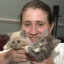
- Play with the kittens.
- Mid-week day hike.
- Go the the gym and take some Pilates reformer classes.
- Help a friend plan a backpacking trip for this weekend.
Karate training has been going well. I hope to test for blue belt in Janurary.
Tom and I have been "training" for the New Zealand trip by hiking a lot. Sometimes just the two of us, sometimes with a group. When it was still hot out we led our own trips because it was harder to find people to hike with because of the heat. But I found that it was not too bad if you plan it right. Choose trails with good tree cover and hike down ridges that are in shadow during the time of the day of your hike (for example, hike down the western slope of the SNP in the morning). A bug net for your face is a must for summertime hiking too.
Now that the weather is good and the trees are pretty, there is no shortage of hiking companions. Saturday we went hiking with the OASC/PATC in the SNP and there was about 12 of us. Most of the leaves had fallen off the trees in the lower elevations, and the upper elevations had about a quarter of the leaves left. Only oaks and beech leaves remain on trees. I think that the general population does not realize that peak color in the mountains is about 2-3 weeks before the valley. Tom and I have been enjoying fall color at various elevations for almost 8 weeks.
Last weekend's hike was from the Pinnacles Overlook, along Whiterocks ridge and along Hazel River. The first and last miles were not fun due to the steepness of the trail and poor footing from the fresh wet leaves. Overwise the hike was very nice. The weather was very warm (70s in the valley) and humid with some sprinkles at the end (I hiked in a t-shirt and shorts). We ate lunch next to nice waterfall that was flowing well due to the recent rain. There were some nice old growth trees along the Hazel River Trail, and I found a poplar leaf on the ground measuring over 10 inches wide.
I don't have any pictures for you yet, but here are is the gps info. We hiked 10 miles, climbed about 2000' at an average speed of 1.8 mph.
 |
| From Hazel Mt-Whiterocks SNP |
 |
| From Hazel Mt-Whiterocks SNP |
Sunday, October 18, 2009
Hiking in the Snow
Tom and I went hiking with the Charlottesville Hiking Meetup Group to Shenandoah National Park. We started at the west side of the park near Grottoes and ascended Paine Run Fire Road to Blackrock Gap, and returned along Trayfoot Mountain Trail. Average temperatures 35-45 with some snow at Trayfoot Mt. and hoar frost at Blackrock Gap. A bit cold and breezy the whole hike. Lunch was fast and we finished in 5 hours. Total distance was 10 miles and overall elevation change was 2000'.
Overall this was one of my favorite hikes in many months due to the changing leaves and weather. Trayfoot Mountain Trail descending into Lefthand Hallow was particularly beautiful with rock formations and overlooks.
 |
| Hoar Frost at Blackrock. From Trayfoot |
 |
| Early season snow was beautiful on the colored leaves along the Trayfoot Mountain Trail. From Trayfoot |
Saturday, October 17, 2009
Karate Rank Exam School Visit
Today I went to a friend's karate school to watch a rank exam. Here are some of my observations in compare/contrast form.
testing style: them - about thirty people tested, including one black belt (from brown); many people showing forms at the same time; total time about 2 hours; us - black belts test separate dates; less people testing (5-10); kyup exam taking about 3 hours; kata forms usually shown individually.
dojo: us - part of athletic club with no extra participation fees; small test fee to cover incidentals; kendo sister school; them - stand-alone building, business run by main instructor; no test fee (at least for lower belts); other parts include day care and boxing school.
belts: us - white, yellow, green, blue, brown, black; them - white, yellow, orange, green, blue, purple, brown, brown w/black stripe (black belt candidate), black, red ("dragon club"). black belt instructors wore blue tops, black bottoms; orange and up wear all black; white and yellow belts wear all white.
bowing: them - left foot comes to right; us - opposite
formality: them - I read a sign instructing students to bow when entering dojo, but I did not see a single person do this; no bowing before or after kata, to flags, or when dismissed; only bowing I remember was before sparring, and to open and close class. us - we bow to the flags when entering and leaving the dojo, when sitting and standing up from side, we bow to the instructor at start and end of class, start and end of kata, when dismissed to the side.
stances: us - low and strong, emphasis from beginning (white belt) on foot and knee direction; them: high, less emphasis on foot position/direction
kiai: them - not emphasized, optional for black belt candidate; us - essential for intensity, power, intimidation; emphasized from beginner level.
breathing: them - emphasized only for black belt candidate; us - introduced at beginning, part of training for blue
intensity: them - not seen until brown; us - required for blue
kicks: them - snappy, not turning base foot, fists up whole time; us - more thrusting, turn base foot, hands down for counterbalance
kata: them - shorter, less intensity in all ranks; overall less emphasis than sparring; no partner kata; us -much time and effort emphasis, longer, more deliberate, intensity required for blue and encouraged from beginning.
sparring: them - full contact at upper levels, padding (head, chest, hands, forearm, shin, feet, mouth guard), small ring; lots of bouncing, little passing; us - limited contact zone all ranks, no padding, must learn to control punches, control space is 3-4x bigger, variety of staring positions (close, regular, far)
sparring stance: them - fists up like boxer's, body forward facing; us - fight stance (body side facing, front knife hand up at chin level, rear fist at center)
self defense: them - no separate warm-up for falls; most forms send opponent's face straight towards ground, using hair, face, neck; less variety of offensive moves to defend from; very little (no?) tumbling; less organized ("first move of x kata"); not well studied among all ranks, even black belt candidate
weapons: them - dual sticks about 3 ft long of bamboo; a few forms with them including defenses and something that looked like a partner kata, but no formal solo kata; us - knife, three forms starting at green; bo starting at brown?; both with defense forms, solo and partner katas.
[edit:]
While the black belt candidate was demonstrating kata, an instructor asked her to re-do it with better breathing and intensity. Without thinking, I clapped (and everyone followed) after her second try because it was so much better. The head instructor glared at me and said NO (clapping, booing, feedback, etc, is encouraged at all times during Myo Sim rank exams). But the sparring matches sounded like an arena.
I summary, I really enjoyed watching this rank exam of another school with my friend (even though I was publicly chastised for offering feedback). It was an eye-opening experience and made me appreciate my school and style. I would like to think that Myo Sim is prettier while being more practical. In a sparring match (with or without gear), most kyup students would be equally matched, but the Myo Sim Black Belts would do better (IMHO). It was helpful to have my friend, an orange belt at the school, there with me to answer my random questions during the test. However, he did not know the country of origin or founder of his style.
I recently found a good panoramic photo stitching software that seems to work really well. It's called Autostitch and it's free. And pretty easy to use. It automatically straightens and balances the exposure, and I think it corrects barrel distortion. Here is as example of my recent trip to Black Rock in the Shenandoah National Park:


I used the panoramic assist program mode in my Nikon P50 which helps you overlap about 20% of the frame and line up the horizon. I have not used it with my D100 and a tripod, but I will show you an example soon, so stay tuned.
 |
| From Austin Mt-Furnace Mt Hike SNP |
Tuesday, October 13, 2009
Monday, October 12, 2009
Fun With GPS
I love maps. Maps of all types. Historical, political, nautical, fantasy (my favorite is Middle Earth), and especially topographical. And when you mix maps with an portable electronic gadget you have a recipe for fun.
Tom thinks I am crazy for wanting to document every location of every picture I ever take. But I like recording this sort of info especially when we are in the wilderness or traveling. For the longest time I was geotagging manually. This is the process of using a program like Google Earth to point to the spot where you know (or guess) the picture was taken, and then the software records the latitude and longitude coordinates on the exif metadata tags.
Don't get me wrong. Google Earth is great, but the process of geotagging is slow. There are more simple programs out there, but I was still running into the problem of not knowing or remembering the exact location of the photo. And after a ten-day trip, this can be impossible.
That's when I started looking into real-time geotagging devices for my camera. But they are expensive and camera specific (and I would probably need to upgrade my camera). For the same price range you can get a unit with topo maps, bells, and whistles too.
The trick for me was to find out how to use the gps unit to automatically geotag my pictures. Automatic is the key, considering I take about 1000 exposures on a 1-week trip. It took quite a bit of hunting around on the internet and experimenting with my unit before I came up with the solution.
The key to automatically geotagging your photos is simple - time and date stamp. Every camera records the time and date taken, according to what you set of course. It is stored in the metadata tags, an invisible universal packet of info that comes with each photo.
So I knew that all I needed was a gps unit that could record my movement in a file with date, time, and location, and the ability to download the data at the end of the trip. In the gps world, this is called a track, and the universal file format is gpx. It turns out that almost all modern gps units will do this.
The next step was to find software (preferable free) to read the gpx track file, interpolate where necessary, and write the metadata tags automatically. Surprisingly, Microsoft Pro Photo Tools easily does just that. It will also allow you to change the time/date stamp if your camera was accidentally set wrong. To make things easy, you just make sure the gps and camera are set to approximately the same time.
I purchased a simple Garmin etrex Venture HC. It will save 10,000 track points, and a typical hike takes about 2,000 (you can change the resolution setting). I wish I had spent a little more money (well an extra $100) on a unit that has an optional removable SD memory card (my unit has only 24k) so I could go longer without downloading (I don't typically travel with my laptop). I also got the US Topo Maps.

I plan to track every minute of my trip to New Zealand. Matt said I could use his laptop to download data when needed. I don't have New Zealand maps yet, but I found a NZ Road Map opensource project that looks promising.
Tom thinks I am crazy for wanting to document every location of every picture I ever take. But I like recording this sort of info especially when we are in the wilderness or traveling. For the longest time I was geotagging manually. This is the process of using a program like Google Earth to point to the spot where you know (or guess) the picture was taken, and then the software records the latitude and longitude coordinates on the exif metadata tags.
Don't get me wrong. Google Earth is great, but the process of geotagging is slow. There are more simple programs out there, but I was still running into the problem of not knowing or remembering the exact location of the photo. And after a ten-day trip, this can be impossible.
That's when I started looking into real-time geotagging devices for my camera. But they are expensive and camera specific (and I would probably need to upgrade my camera). For the same price range you can get a unit with topo maps, bells, and whistles too.
The trick for me was to find out how to use the gps unit to automatically geotag my pictures. Automatic is the key, considering I take about 1000 exposures on a 1-week trip. It took quite a bit of hunting around on the internet and experimenting with my unit before I came up with the solution.
The key to automatically geotagging your photos is simple - time and date stamp. Every camera records the time and date taken, according to what you set of course. It is stored in the metadata tags, an invisible universal packet of info that comes with each photo.
So I knew that all I needed was a gps unit that could record my movement in a file with date, time, and location, and the ability to download the data at the end of the trip. In the gps world, this is called a track, and the universal file format is gpx. It turns out that almost all modern gps units will do this.
 |
| From Rocky-Brown Mountain Hike SNP |
The next step was to find software (preferable free) to read the gpx track file, interpolate where necessary, and write the metadata tags automatically. Surprisingly, Microsoft Pro Photo Tools easily does just that. It will also allow you to change the time/date stamp if your camera was accidentally set wrong. To make things easy, you just make sure the gps and camera are set to approximately the same time.
 |
| From Rocky-Brown Mountain Hike SNP |
I purchased a simple Garmin etrex Venture HC. It will save 10,000 track points, and a typical hike takes about 2,000 (you can change the resolution setting). I wish I had spent a little more money (well an extra $100) on a unit that has an optional removable SD memory card (my unit has only 24k) so I could go longer without downloading (I don't typically travel with my laptop). I also got the US Topo Maps.
I plan to track every minute of my trip to New Zealand. Matt said I could use his laptop to download data when needed. I don't have New Zealand maps yet, but I found a NZ Road Map opensource project that looks promising.
Sunday, October 11, 2009
A Nice Walk in the Park on an Autumn Day
Today Tom and I hiked 12 miles in Shenandoah National Park. We decided to finally buy an annual park pass hoping to get a lot of use out of it preparing for our trip (it takes two visits to break even). And we are fortunate to be living close to a wonderful national park.
We hit the trail at 9am when it was still 45 degrees out, but quickly warmed up. From the Brown Gap parking area we headed along the Austin Mountain trail along a very rocky ridge. The walking was slow and treacherous but fun because of the uniqueness. Then we headed down to Madison Run and up Furnace Mountain for a long and steady 2000' climb. Lunch was very nice from a rocky ledge overlooking the ridge we just crossed.
The final 1000' climb to Black Rock was a little difficult for me because my legs and back were getting sore, but Tom encouraged me along. In all we finished in 6 hours 45 minutes.
Other than some normal soreness from hiking 12 miles, my feet felt fine with the new insoles. I was not carrying as much as I usually do, only about 8 pounds. My boots did ok, I am still torn if I really need a new pair. My ankles twist a lot in these and I am not sure a new pair would help that much.
We hit the trail at 9am when it was still 45 degrees out, but quickly warmed up. From the Brown Gap parking area we headed along the Austin Mountain trail along a very rocky ridge. The walking was slow and treacherous but fun because of the uniqueness. Then we headed down to Madison Run and up Furnace Mountain for a long and steady 2000' climb. Lunch was very nice from a rocky ledge overlooking the ridge we just crossed.
 |
| From Austin Mt-Furnace Mt Hike SNP |
The final 1000' climb to Black Rock was a little difficult for me because my legs and back were getting sore, but Tom encouraged me along. In all we finished in 6 hours 45 minutes.
 |
| From Austin Mt-Furnace Mt Hike SNP |
Other than some normal soreness from hiking 12 miles, my feet felt fine with the new insoles. I was not carrying as much as I usually do, only about 8 pounds. My boots did ok, I am still torn if I really need a new pair. My ankles twist a lot in these and I am not sure a new pair would help that much.
Saturday, October 10, 2009
Thursday, October 8, 2009
Hiking Boots
I have what is coined by the shoe/boot industry as "low volume" feet. Not only are my heels narrow, but my overall feet are skinnier than average. According to a sales guy at Richey Shoes only 1% of the U.S. population fall into this category. I find this statistic hard to believe, but this is the excuse most shoe and boot manufacturers have to only make regular and wide sizes. For most shoes I can get away with regular width, and I have found some brands that err on the narrow side.
When it comes to hiking boots you have to have them properly fitted. If they are too wide in the heel, they will slip with every step and cause blisters every time. The boot must grip your heel and move with you. If the rest of your foot does not fill the boot it will slide and allow your ankle to twist and trip. This is my problem with my current pair of boots. They were almost narrow enough for me when I first bought them 8 years ago, and over time they have stretched and allow my foot to move around.
Boot problems get worse when you add a backpack, which is what happened on our Dolly Sods backpacking trip. My feet and ankles hurt so bad by the end of that trip (granted it was some of the most treterous hiking I have ever done). That's when I decided I need a new pair of boots.
I have ordered and returned two different pairs since. New Balance makes a nice pair of narrow boots ($150), but the size 10 was too small (my usual size), and the thought of buying 10.5 size anything makes me cringe. Plus they were too small in the sides of my fore foot, and I don't thing a half size will fix this. Unlike dress shoes and even running shoes, boots must have a roomy "toe box" to allow your toes to flex and spread with each step.
My second pair of tryout boots were Asolo Atlantis. ($133 at alssports.com) These run narrow, and fit me pretty well, but still slipped a little in the ankle. So I decided to return them and hold out for the perfect boot (but now I am wondering if I should have kept them).
Now I have my eye on a pair of Lowa Renegade that are sized narrow ($190 at Bakershoe.com). But they are out of stock and the factory won't be making them in narrow for another few months.
So now I am quickly running out of time to break in a new pair of boots before the trip. I have trid Plan B, which is new insoles. I tried Superfeet for a long time, but they hurt my feet even after they were broken in. Currently I am trying Orthofeet BioSole Gels that I got at Richey & Co. The sales guy there said that I am not used to having my arch supported, so the new insoles will feel weird. So far they are ok, but I have not hiked in them yet.
I have my eyes on a pair of Lowa Banff Pro narrows. But they are pricey and possibly too heavy. What makes them unique is their leather lining (instead of gore tex). It is supposed to be more foot-conforming and breathable, while just as waterproof.
Wednesday, October 7, 2009
NZ Prep Time
A friend asked that I blog more about my trip to New Zealand, so here it is, not to entice jealousy, but to share my excitement.
The 25-day trip itinerary is very full, with 13 days of hiking, 3 days of canoe/sea kayaking, 3 ferry rides, and over 35 hours of driving. Much of the hiking is over steep and rough terrain. Tom and I have been hiking almost every weekend for the last several months to prepare for this aspect of the trip. It seems that since my back injury my feet became soft and my legs complacent. My goal is to be able to hike 12 miles with an elevation change of 3000' in less than 8 hours with a 20 pound pack. Tom is a very good hiker and I have no worries about him being able to complete all of the NZ hikes, and I am about half way to my conditioning goal. My other goal to make NZ more enjoyable is to drop another 15 pounds. I will keep you updated on my hiking and weight goals. To see the hikes completed so far, see my web album.
We will have three free days in Queenstown, the adventure capital of the world, so I will be blogging about what to do here.
Another aspect of trip preparation is shopping. We won't have much room for our stuff, but the urge to go wild is overwhelming. "But it's a once in a life-time trip, and I need it." Well, luckily (or not), my wonderful husband has great restraint. My biggest shopping element is hiking boots, which I will talk more about later.
Stay tuned.
Friday, August 7, 2009
Travel Blog Coming Soon.
Tom and I got back from our trip Monday, but since then we have been be very busy. I have been spending my spare time working on the 1000+ photos we took. I have also re-immersed myself completely in working out. The hiking on this trip made me realize how out of shape I am, and how much I need to improve before our trip to New Zealand. That also means losing 25 pounds in 25 weeks, which is quite doable, trips to the gym almost every day, and hiking every weekend.
Check back soon for my travel blog. I journaled every day of the trip, so you will all get accurate first-hand accounts of our activities. Unlike my everglades trip where I tried to make a blog post of every day of the trip, I will be splitting it up into one blog per section: Grand Tetons, Yellowstone, and Craters of the Moon.
In the mean time, please check out all of my hard work at my web album for photos. Add comments too. If you have a google account, please add me as a "favorite." This is done by clicking on "Add to Favorites" in the top of the right column under "Photos by Jennifer." If you do this I will feel like a million bucks with a fan base, and you can get updates when I add new photos.
Saturday, August 1, 2009
Craters of the Moon and Arco, Idaho.
Day 9
While cooking breakfast at the campsite, a young coyote visited us. He just walked through the campsite sniffing the air, and just kept walking. Sorry, no pictures.
We hiked several more trails around the park among the lava flows, including large mounds and craters. I had fun reading the interpretative guide out loud to the guys while we walked from site to site. At least they seemed interested.
By noon, things were really cooking, so we decided to make a beer run in Arco. The submarine sail was intriguing and we stopped to take a look. There were torpedos and other war memorials there, along with a retired guy who talked about his work on nuclear sub engine testing at Electric Boat.
Back at camp, we cooked an awesome dinner of chicken fajitas among night hawks flying overhead.
We took down our tent because there was no tree shade at the campsite, and decided to sleep under the stars on a tarp in our sleeping bags. Not too cold, but the moon was sooo bright, I had to cover my eyes with a tee shirt to get to sleep. And no dew in the morning either, it is the desert after all. I slept great, but Tom did not because he was worried about the moths landing on his face.
While cooking breakfast at the campsite, a young coyote visited us. He just walked through the campsite sniffing the air, and just kept walking. Sorry, no pictures.
 |
| From Craters of the Moon NM |
We hiked several more trails around the park among the lava flows, including large mounds and craters. I had fun reading the interpretative guide out loud to the guys while we walked from site to site. At least they seemed interested.
 |
| From Arco |
By noon, things were really cooking, so we decided to make a beer run in Arco. The submarine sail was intriguing and we stopped to take a look. There were torpedos and other war memorials there, along with a retired guy who talked about his work on nuclear sub engine testing at Electric Boat.
Back at camp, we cooked an awesome dinner of chicken fajitas among night hawks flying overhead.
We took down our tent because there was no tree shade at the campsite, and decided to sleep under the stars on a tarp in our sleeping bags. Not too cold, but the moon was sooo bright, I had to cover my eyes with a tee shirt to get to sleep. And no dew in the morning either, it is the desert after all. I slept great, but Tom did not because he was worried about the moths landing on his face.
Friday, July 31, 2009
Craters of the Moon
Day 8 - Friday July 31, 2009, continued.
Craters of the Moon National Monument was only a three hour drive west of Yellowstone and well worth the trip. I was happy to get some desert air before leaving the west. It was such a contrast in environment that it helped round out the entire trip. And it was nice to get away from the crowds.
The park is unique landscape of lava flows that occurred 15,000 to 2,000 years ago, a now dormant thermal feature before it "moved" on to the Yellowstone region.
Soon after arriving, we explored lava tubes, which are caves formed by lava flows. Some were three stories tall, and others were small and deep with ice and mineral deposits. Pete made sure we were well prepared, and told us to pack head lamps, helmets, and jeans. This made it much safer, because the rock was very sharp. These were "wild" caves: no paved floors or built-in lighting.
We stayed in tents at the park campground on the edge of the lava flow. Quite possibly the weirdest place I have ever slept.
Craters of the Moon National Monument was only a three hour drive west of Yellowstone and well worth the trip. I was happy to get some desert air before leaving the west. It was such a contrast in environment that it helped round out the entire trip. And it was nice to get away from the crowds.
 |
| From Craters of the Moon NM |
The park is unique landscape of lava flows that occurred 15,000 to 2,000 years ago, a now dormant thermal feature before it "moved" on to the Yellowstone region.
 |
| From Craters of the Moon NM |
Soon after arriving, we explored lava tubes, which are caves formed by lava flows. Some were three stories tall, and others were small and deep with ice and mineral deposits. Pete made sure we were well prepared, and told us to pack head lamps, helmets, and jeans. This made it much safer, because the rock was very sharp. These were "wild" caves: no paved floors or built-in lighting.
 |
| From Craters of the Moon NM |
We stayed in tents at the park campground on the edge of the lava flow. Quite possibly the weirdest place I have ever slept.
 |
| From Craters of the Moon NM |
Yellowstone to Craters of the Moon
Day 8 - Friday July 31, 2009
After several extensive searches of all three rental vehicles, I concluded that my brand new GPS was lost. I am notorious for misplacing things, so I did not panic when I could not find it the previous day. In my search and disarray, Tom called the park headquarters and found it. It turns out that I left it at the Old Faithful Visitor Center two nights ago, and they took it to the Park headquarters in Mammoth Springs. The only problem is that it was 35 miles out of the way (70 round trip) from the route to our next destination in Idaho. Luckily, everyone in our car was ok with this side trip down a road we had not traveled yet. We were rewarded with a grizzly bear sighting (in the distance) and a bald eagle near the road.

My Lonely Planet Guide turned out to be valuable this trip, but it too has its flaws. We decided to stop in West Yellowstone for lunch, and the recommended restaurant was closed, and replace by another. We decided to give it a try anyway, because of its name, "Kiwi." It turned out to be a New Zealand joint run by a native. We told her about our upcoming trip, and she gave us some tips about eating out in her country. The British style fish-and-chips were excellent.

After several extensive searches of all three rental vehicles, I concluded that my brand new GPS was lost. I am notorious for misplacing things, so I did not panic when I could not find it the previous day. In my search and disarray, Tom called the park headquarters and found it. It turns out that I left it at the Old Faithful Visitor Center two nights ago, and they took it to the Park headquarters in Mammoth Springs. The only problem is that it was 35 miles out of the way (70 round trip) from the route to our next destination in Idaho. Luckily, everyone in our car was ok with this side trip down a road we had not traveled yet. We were rewarded with a grizzly bear sighting (in the distance) and a bald eagle near the road.
My Lonely Planet Guide turned out to be valuable this trip, but it too has its flaws. We decided to stop in West Yellowstone for lunch, and the recommended restaurant was closed, and replace by another. We decided to give it a try anyway, because of its name, "Kiwi." It turned out to be a New Zealand joint run by a native. We told her about our upcoming trip, and she gave us some tips about eating out in her country. The British style fish-and-chips were excellent.
Thursday, July 30, 2009
Yellowstone, continued
Day 7
They say that you will see more wildlife driving the roads of Yellowstone than hiking the trails of Yellowstone. Well, this seemed to be true for us, especially early in the morning. On the way to Mammoth Springs in the north-west part of the park we saw a grey wolf near the road that was supposedly feeding on a carcass in a small hollow. The only way we knew it was there was the people pulled over with a ranger all pointing at the same spot in the distance. After several views through my binoculars (also necessary equipment in Yellowstone), I was able to catch a single shot of the wolf.
Mammoth Springs was a nice visit and less crowded because we were there early in the morning. These were different from the springs of the Old Faithful area because of the beautiful terraces.
The Grand Canyon of Yellowstone and it's waterfalls were beautiful, I just wish that we could have hiked the canyon instead of just driving around it and getting out of our cars to see it. Maybe next time :)

We found a herd of bison near the road, with some bulls surrounding a group of cows and calves. Two bulls had a fight, close enough that we could hear them grunting and their heads clanking together when they charged. Just like on the nature shows. A little too close actually, just enough to make my heart skip a beat.


Off to the side of the same field, I captured one of my favorite images of the Yellowstone portion of the trip. A solitary bull next to the Yellowstone River.

They say that you will see more wildlife driving the roads of Yellowstone than hiking the trails of Yellowstone. Well, this seemed to be true for us, especially early in the morning. On the way to Mammoth Springs in the north-west part of the park we saw a grey wolf near the road that was supposedly feeding on a carcass in a small hollow. The only way we knew it was there was the people pulled over with a ranger all pointing at the same spot in the distance. After several views through my binoculars (also necessary equipment in Yellowstone), I was able to catch a single shot of the wolf.
 |
| From Yellowstone NP |
Mammoth Springs was a nice visit and less crowded because we were there early in the morning. These were different from the springs of the Old Faithful area because of the beautiful terraces.
 |
| From Yellowstone NP |
The Grand Canyon of Yellowstone and it's waterfalls were beautiful, I just wish that we could have hiked the canyon instead of just driving around it and getting out of our cars to see it. Maybe next time :)
We found a herd of bison near the road, with some bulls surrounding a group of cows and calves. Two bulls had a fight, close enough that we could hear them grunting and their heads clanking together when they charged. Just like on the nature shows. A little too close actually, just enough to make my heart skip a beat.
Off to the side of the same field, I captured one of my favorite images of the Yellowstone portion of the trip. A solitary bull next to the Yellowstone River.
Wednesday, July 29, 2009
Day 6
A small group of us got up early to see the sun rise over Yellowstone Lake from a marina not far from our campsite. Not much of a show, but we discovered a nice cafe there that served a hot buffet breakfast.
Tom went with Pete and others to hike, including a climb of Mt. Washburn. I decided not to go with them because of my foot blisters and overall body fatigue.
Saw more thermals at West Thumb Basin, just up the road from our campsite. Springs were smaller here but different because of more unique vegetation and animals, and the pools drained into the lake.
After lunch we headed back to the Old Faithful area for more thermals, and for what turned out to be my favorite time at the park. We started at the Biscuit Basin and took a nature trail to the Upper Geyser Basin. This was a beautiful flat trail through a mostly open field (also cleared by fire recently, across creeks, and through a small grove of pines to more thermals. We had more good geyser luck, because the best one in the park, Riverside Geyser, that erupts every 6-8 hours, started just as we go there. And the lighting was perfect - evening sun at my back. The plume shot over the river with a lovely grassy hill and pines in the background. Ten times better than Old Faithful.
A small group of us got up early to see the sun rise over Yellowstone Lake from a marina not far from our campsite. Not much of a show, but we discovered a nice cafe there that served a hot buffet breakfast.
Tom went with Pete and others to hike, including a climb of Mt. Washburn. I decided not to go with them because of my foot blisters and overall body fatigue.
 |
| From Yellowstone NP |
Saw more thermals at West Thumb Basin, just up the road from our campsite. Springs were smaller here but different because of more unique vegetation and animals, and the pools drained into the lake.
 |
| From Yellowstone NP |
After lunch we headed back to the Old Faithful area for more thermals, and for what turned out to be my favorite time at the park. We started at the Biscuit Basin and took a nature trail to the Upper Geyser Basin. This was a beautiful flat trail through a mostly open field (also cleared by fire recently, across creeks, and through a small grove of pines to more thermals. We had more good geyser luck, because the best one in the park, Riverside Geyser, that erupts every 6-8 hours, started just as we go there. And the lighting was perfect - evening sun at my back. The plume shot over the river with a lovely grassy hill and pines in the background. Ten times better than Old Faithful.
 |
| From Yellowstone NP |
Tuesday, July 28, 2009
West, Phase 2 - Yellowstone
Day 5
Previous night was cold (lower 40s) and we had a heavy dew. We packed up our wet tents and headed to Yellowstone via Rockefeller Parkway. Lost of construction and considerable delays. The road is completely removed in some portions, down to the dirt. I am guessing the were re-grading the road (removing peaks and valleys). Recent wildfires made for a clear view from the car. Many standing and fallen dead trees in a sea of new pines and grasses was a unique environment to see.
The group set up camp at Grant Village near Thumb Bay and went straight to Old Faithful. We could not find a parking spot so we headed north so visit the other geyser basins. Everything was beautiful and felt like a different world. Spasm Gyser was just starting to erupt we go there (lucky!) - huge, wide, and we could get very close, feel the seam and spitting spray. My favorite was the Grand Prismatic Poll - the largest and deepest, with a lot of bacteria mats in every direction.
Then we head backed to Old Faithful which erupted within 10 minutes of arrival (lucky again!). I was not as impressed with it as I was of Spasm Geyser because we could not get as close and it was over in just a few minutes (Spasm was still erupting when we left). But it was nice to sit in the bleachers and talk with others while we waited. A guy was telling us about his troubles with his RV (I am glad we did not have to deal with one).
After the eruption we visited the Old Faithful Inn, a beautiful old log lodge. We did not have much time to look around, but we did make dinner reservations for the next day.
Previous night was cold (lower 40s) and we had a heavy dew. We packed up our wet tents and headed to Yellowstone via Rockefeller Parkway. Lost of construction and considerable delays. The road is completely removed in some portions, down to the dirt. I am guessing the were re-grading the road (removing peaks and valleys). Recent wildfires made for a clear view from the car. Many standing and fallen dead trees in a sea of new pines and grasses was a unique environment to see.
 |
| From Grand Tetons NP |
The group set up camp at Grant Village near Thumb Bay and went straight to Old Faithful. We could not find a parking spot so we headed north so visit the other geyser basins. Everything was beautiful and felt like a different world. Spasm Gyser was just starting to erupt we go there (lucky!) - huge, wide, and we could get very close, feel the seam and spitting spray. My favorite was the Grand Prismatic Poll - the largest and deepest, with a lot of bacteria mats in every direction.
 |
| From Yellowstone NP |
Then we head backed to Old Faithful which erupted within 10 minutes of arrival (lucky again!). I was not as impressed with it as I was of Spasm Geyser because we could not get as close and it was over in just a few minutes (Spasm was still erupting when we left). But it was nice to sit in the bleachers and talk with others while we waited. A guy was telling us about his troubles with his RV (I am glad we did not have to deal with one).
 |
| From Yellowstone NP |
After the eruption we visited the Old Faithful Inn, a beautiful old log lodge. We did not have much time to look around, but we did make dinner reservations for the next day.
Monday, July 27, 2009
Grand Tetons, continued
Day 4
Hike around Jenny Lake and visit Jackson Hole, WY
Tom, Clement and I get up early to take Dan to his climbing class. We received a great reward of morning sunlight hitting the Tetons with a beautiful ribbon of clouds. Plus some elk.
It was a beautiful start to our hike around Jenny Lake, but within an hour, a total downpoor plus lightening and thunder.
Our group is prepared, so we hike on. The lake is smaller than Jackson, but the vegetation is completely different. Much more green. We see fern, columbine and lots of other wildflowers.
There are few people until we pass the side trail from the ferry. Turns out this is the most popular hike in park. It's funny to watch all the people in tank tops, shorts, flip-flops, and NO rain gear try to navigate the slippery rocks as the temperature drops. The rain helps only somewhat to alleviate the crowds. Cascade Falls are beautiful but crowded.
Tom and Jere decide to walk back, the rest of us take the ferry across the lake to avoid the second wave of thunderstorms.
Dinner at Snake River Brewery in Jackson is good and fun. The group has fun exploring the town and many shops.
Hike around Jenny Lake and visit Jackson Hole, WY
Tom, Clement and I get up early to take Dan to his climbing class. We received a great reward of morning sunlight hitting the Tetons with a beautiful ribbon of clouds. Plus some elk.
 |
| From Grand Tetons NP |
It was a beautiful start to our hike around Jenny Lake, but within an hour, a total downpoor plus lightening and thunder.
 |
| From Grand Tetons NP |
 |
| From Grand Tetons NP |
 |
| From Grand Tetons NP |
There are few people until we pass the side trail from the ferry. Turns out this is the most popular hike in park. It's funny to watch all the people in tank tops, shorts, flip-flops, and NO rain gear try to navigate the slippery rocks as the temperature drops. The rain helps only somewhat to alleviate the crowds. Cascade Falls are beautiful but crowded.
 |
| From Grand Tetons NP |
Tom and Jere decide to walk back, the rest of us take the ferry across the lake to avoid the second wave of thunderstorms.
Dinner at Snake River Brewery in Jackson is good and fun. The group has fun exploring the town and many shops.
Sunday, July 26, 2009
Day 3
A full day of hiking the Hermitage Point Trail around Colter Bay and Jackson Lake. About nine miles, very little elevation change. We see and/or heard blue herons, geese, ducks, osprey, bald eagles, cormorants, sea gulls, Clarks' nutcracker, juncos, kinglets, and a beaver or muskrat. Lots of chickmonks and ground squirells. Amaizing scenery of the bay, boats, lakes, ponds, rivers, creeks, forest, meadows, wildflowers, and the Grand Teton Montains. The air is clear, the sky is blue with a few fluffy white clouds. Some of the peaks still have snow on them.
The trail is not crowded, but we see plenty of motor boats so we don't even get a hint of back country feel. At least this sculler made for a nice picture.
The campground is nice but a little noisy. Motorcycles head in and out at all hours. We get rain almost every evening and the temperatures dip into the 30s every night, but we are prepared. Tom and I have a leak-free tent, warm sleeping bags, and earplugs. It's a nice respite from the sweltering heat and humidity back east.
A full day of hiking the Hermitage Point Trail around Colter Bay and Jackson Lake. About nine miles, very little elevation change. We see and/or heard blue herons, geese, ducks, osprey, bald eagles, cormorants, sea gulls, Clarks' nutcracker, juncos, kinglets, and a beaver or muskrat. Lots of chickmonks and ground squirells. Amaizing scenery of the bay, boats, lakes, ponds, rivers, creeks, forest, meadows, wildflowers, and the Grand Teton Montains. The air is clear, the sky is blue with a few fluffy white clouds. Some of the peaks still have snow on them.
The trail is not crowded, but we see plenty of motor boats so we don't even get a hint of back country feel. At least this sculler made for a nice picture.
 |
| From Grand Tetons NP |
The campground is nice but a little noisy. Motorcycles head in and out at all hours. We get rain almost every evening and the temperatures dip into the 30s every night, but we are prepared. Tom and I have a leak-free tent, warm sleeping bags, and earplugs. It's a nice respite from the sweltering heat and humidity back east.
Subscribe to:
Posts (Atom)