Showing posts with label hiking. Show all posts

Friday, April 16, 2010

Sunday's Hike

So I am a little behind on my outdoor activity blog posting, but I am diligently blogging away. This hike was last Sunday 4/14, a lovely spring day.

Day hike with Jere/OASC.
Wildcat Ridge-Riprap SNP
9.5 mi
average speed 2mph
elevation gain approx 2000ft
Weather: clear, sunny, hazy, average temperature 70F.

A little crowded from Chimney Rock to AT, otherwise light traffic. Nice lunch near a pool with rock slide/waterfall (note:come back in August!). Water was very cold, but Roland jumped in anyway! Three dachshunds barked loudly at us while walking by un-leashed with their owners. I got sunburned on the right side of my neck.

Jere lead us on a side trail to a 'cave' that was not much more than a rocky overhang with a rock wall that someone built around it. A black vulture found the cave to be very good for a nest however, and was spooked by our arrival.
Wildcat Ridge-Riprap SNP

Wednesday, April 7, 2010

Old Rag Day Hike

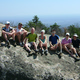
Tom and I had Good Friday off from work, so we decided to go hiking with OASC leader Brian B. Old Rag is one of the most crowded hikes in the Shenandoah National Park, and we were hoping that not to many other people had Friday off too. This was my second trip along the Ridge Trail, but Tom's first and I think he had a lot of fun. Here's our group at the summit, near where we ate lunch, with us facing east.
From Old Rag Mt from Berry Hollow

The weather was hot and sunny, and as you can see from the picture, hazy, but nice. It seems that we just skipped over spring and went straight to summer! But it was good to see all the signs of spring on the forest floor, and due to the elevation of this area, I think it's all a few weeks behind from where we live.
From Old Rag Mt from Berry Hollow
Brian usually likes to eat lunch at this rocky area because it is less crowded, but we voted to find more shade because it was so hot!
From Old Rag Mt from Berry Hollow

I was surprised to see how "smooth" this track is, just a steady up and down, without too many "bumps."
From Old Rag Mt from Berry Hollow

I just learned how to view the gps tracks in Google Earth. The view of Old Rag is particularly interesting, because the rocks are so big and non-tree-covered that they show on the satellite picture!
From Old Rag Mt from Berry Hollow

This route is the secret "back door" to Old Rag, especially good if you are coming in from the south.
From Old Rag Mt from Berry Hollow

You can view the OASC group's photos, and all of the photos I took in the link below.
Old Rag Mt from Berry Hollow

Wednesday, November 11, 2009

Hiking Training Progress Report

We have about 100 days until the trip and have been working hard at improving my stamina for long distance hiking.  In the past 3 months we have hiked about 120 miles, with about 32,600 feet of elevation up and down over 10 day hikes and two backpacking trips.  When I first started, my average day hike speed was 1.4 mph, and now I average 2 mph.  I have been keeping track of everything using my GPS.

I have lost 10 pounds and gained a lot of muscle.  Hiking is more enjoyable and I feel more confident and less clumsy.  But I still have a ways to go with overall speed, especially with a pack.  I have to get up to 2.5 mph to match the leader's low speed.

Sunday, November 8, 2009

did you fall in?

Tom and I spent the weekend backpacking at Ramsey's Draft Wilderness Area in the George Washington National Forest.  We went with our friend Keith from the club whom we have backpack with before and is very experienced.  John from Blue Ridge Mountain Sports gave me inspiration and advice for the trip after others had told me it was too difficult and easy to get lost.

The first day of the trip was much different than your average hike.  We followed the river and crossed it many times.  The area is designated "Wilderness" so no trail blazes are allowed, and no trail maintenance is performed.  That means if a 4-foot-diameter tree falls across the path, you have to climb over/under it, or hike around it, which is not easy on a steep slope with a 30-pound pack.  In a few spots we lost the trail, but quickly found it again.  As long as we took our time we were ok.  We had to trust our instincts-if you feel like you are off the trail, you probably are, so stop and look around. 


From Ramsey's Draft

The river crossings were not too bad in most places, but in one spot the rocks were slippery and I fell in, soaking both boots.  I stopped and rung out my socks and kept going without too much trouble.

The area along the river once had many giant hemlocks, but they were all recently killed by disease.  Hence the reason for many of the roadblocks.  One fell across a particularly deep and fast portion of river and made an excellent bridge.

There were a lot of saplings on the trail whipping in our face as we walked through them.  It made us very appreciative of the regular trail maintenance performed by groups like the PATC.

The final push up Ramsey's Draft to Hiner Spring was difficult and steep. By the end of the first day our feet and backs were very tired but we felt well accomplished.  We hiked only 7 miles in 5 hours, but we did not get lost and no one got hurt.  The camp site was lovely with plenty of flat spots and camp fire wood.  The spring was nearby and we had plenty of time to set up and cook dinner before dark.  Just after dark, several deer came and visited us within 20 feet of the campfire.  We went to sleep around 7:30pm.

My best guess to the overnight low was 40 degrees--not bad for November.  My feet got a little cold (with dry socks) I think because they were on the ground off my sleeping pad (the spot was sloped down slightly and I kept sliding).   Otherwise we were warm in our tents and slept well.   

The second day was much more like a standard Shenandoah mountain hike.  It was longer - 9 miles - but mostly down hill on well marked trails.  The weather was 70 and sunny with a slight breeze.  We saw many old pines and oaks and hiked in leaves knee-deep in places.  Many of the ridge paths were slanted, making us appreciate trail maintenance again.  We averaged 2 mph with stops, a pretty good pace with packs.


From Ramsey's Draft

Overall I had a great time hiking and camping this weekend.  My body hurt less than last time (see Dolly Sods) and I had an easier time keeping up with Tom and Keith.  While hiking I asked myself "why do you like backpack so much when it hurts so much?"  They answer is that I enjoy the adventure getting there, sleeping in the wilderness, and knowing that I have everything I need to survive for two days on my back, and spending quality time with my hubby and friends.  So the goal is to keep getting into shape to make getting there more enjoyable.
From Ramsey's Draft

Birds seen on the trip: downy woodpecker, hairy woodpecker, junco, nuthatch, titmouse.
Monday, November 2, 2009

Tom and I have been "training" for the New Zealand trip by hiking a lot.  Sometimes just the two of us, sometimes with a group.  When it was still hot out we led our own trips because it was harder to find people to hike with because of the heat.  But I found that it was not too bad if you plan it right.  Choose trails with good tree cover and hike down ridges that are in shadow during the time of the day of your hike (for example, hike down the western slope of the SNP in the morning).  A bug net for your face is a must for summertime hiking too.

Now that the weather is good and the trees are pretty, there is no shortage of hiking companions.  Saturday we went hiking with the OASC/PATC in the SNP and there was about 12 of us.  Most of the leaves had fallen off the trees in the lower elevations, and the upper elevations had about a quarter of the leaves left.  Only oaks and beech leaves remain on trees.  I think that the general population does not realize that peak color in the mountains is about 2-3 weeks before the valley.  Tom and I have been enjoying fall color at various elevations for almost 8 weeks. 

Last weekend's hike was from the Pinnacles Overlook, along Whiterocks ridge and along Hazel River.  The first and last miles were not fun due to the steepness of the trail and poor footing from the fresh wet leaves.  Overwise the hike was very nice.  The weather was very warm (70s in the valley) and humid with some sprinkles at the end (I hiked in a t-shirt and shorts).  We ate lunch next to nice waterfall that was flowing well due to the recent rain.  There were some nice old growth trees along the Hazel River Trail, and I found a poplar leaf on the ground measuring over 10 inches wide.

I don't have any pictures for you yet, but here are is the gps info.  We hiked 10 miles, climbed about 2000' at an average speed of 1.8 mph.


From Hazel Mt-Whiterocks SNP


From Hazel Mt-Whiterocks SNP

Sunday, October 18, 2009

Hiking in the Snow

Tom and I went hiking with the Charlottesville Hiking Meetup Group to Shenandoah National Park.  We started at the west side of the park near Grottoes and ascended Paine Run Fire Road to Blackrock Gap, and returned along Trayfoot Mountain Trail. Average temperatures 35-45 with some snow at Trayfoot Mt. and hoar frost at Blackrock Gap. A bit cold and breezy the whole hike. Lunch was fast and we finished in 5 hours.  Total distance was 10 miles and overall elevation change was 2000'. 


Hoar Frost at Blackrock.  From Trayfoot


Early season snow was beautiful on the colored leaves along the Trayfoot Mountain Trail.  From Trayfoot
Overall this was one of my favorite hikes in many months due to the changing leaves and weather. Trayfoot Mountain Trail descending into Lefthand Hallow was particularly beautiful with rock formations and overlooks.

Sunday, October 11, 2009

A Nice Walk in the Park on an Autumn Day

Today Tom and I hiked 12 miles in Shenandoah National Park. We decided to finally buy an annual park pass hoping to get a lot of use out of it preparing for our trip (it takes two visits to break even). And we are fortunate to be living close to a wonderful national park.

We hit the trail at 9am when it was still 45 degrees out, but quickly warmed up. From the Brown Gap parking area we headed along the Austin Mountain trail along a very rocky ridge. The walking was slow and treacherous but fun because of the uniqueness. Then we headed down to Madison Run and up Furnace Mountain for a long and steady 2000' climb. Lunch was very nice from a rocky ledge overlooking the ridge we just crossed.
From Austin Mt-Furnace Mt Hike SNP

The final 1000' climb to Black Rock was a little difficult for me because my legs and back were getting sore, but Tom encouraged me along. In all we finished in 6 hours 45 minutes.
From Austin Mt-Furnace Mt Hike SNP

Other than some normal soreness from hiking 12 miles, my feet felt fine with the new insoles. I was not carrying as much as I usually do, only about 8 pounds. My boots did ok, I am still torn if I really need a new pair. My ankles twist a lot in these and I am not sure a new pair would help that much.

Wednesday, July 29, 2009

Day 6
A small group of us got up early to see the sun rise over Yellowstone Lake from a marina not far from our campsite. Not much of a show, but we discovered a nice cafe there that served a hot buffet breakfast.

Tom went with Pete and others to hike, including a climb of Mt. Washburn. I decided not to go with them because of my foot blisters and overall body fatigue.

From Yellowstone NP


Saw more thermals at West Thumb Basin, just up the road from our campsite. Springs were smaller here but different because of more unique vegetation and animals, and the pools drained into the lake.

From Yellowstone NP

After lunch we headed back to the Old Faithful area for more thermals, and for what turned out to be my favorite time at the park. We started at the Biscuit Basin and took a nature trail to the Upper Geyser Basin. This was a beautiful flat trail through a mostly open field (also cleared by fire recently, across creeks, and through a small grove of pines to more thermals. We had more good geyser luck, because the best one in the park, Riverside Geyser, that erupts every 6-8 hours, started just as we go there. And the lighting was perfect - evening sun at my back. The plume shot over the river with a lovely grassy hill and pines in the background. Ten times better than Old Faithful.

From Yellowstone NP

Monday, July 27, 2009

Grand Tetons, continued

Day 4

Hike around Jenny Lake and visit Jackson Hole, WY

Tom, Clement and I get up early to take Dan to his climbing class. We received a great reward of morning sunlight hitting the Tetons with a beautiful ribbon of clouds. Plus some elk.


From Grand Tetons NP


It was a beautiful start to our hike around Jenny Lake, but within an hour, a total downpoor plus lightening and thunder.

From Grand Tetons NP
Our group is prepared, so we hike on. The lake is smaller than Jackson, but the vegetation is completely different. Much more green. We see fern, columbine and lots of other wildflowers.

From Grand Tetons NP


From Grand Tetons NP


There are few people until we pass the side trail from the ferry. Turns out this is the most popular hike in park. It's funny to watch all the people in tank tops, shorts, flip-flops, and NO rain gear try to navigate the slippery rocks as the temperature drops. The rain helps only somewhat to alleviate the crowds. Cascade Falls are beautiful but crowded.

From Grand Tetons NP


Tom and Jere decide to walk back, the rest of us take the ferry across the lake to avoid the second wave of thunderstorms.

Dinner at Snake River Brewery in Jackson is good and fun. The group has fun exploring the town and many shops.

Sunday, July 26, 2009

Day 3

A full day of hiking the Hermitage Point Trail around Colter Bay and Jackson Lake. About nine miles, very little elevation change. We see and/or heard blue herons, geese, ducks, osprey, bald eagles, cormorants, sea gulls, Clarks' nutcracker, juncos, kinglets, and a beaver or muskrat. Lots of chickmonks and ground squirells. Amaizing scenery of the bay, boats, lakes, ponds, rivers, creeks, forest, meadows, wildflowers, and the Grand Teton Montains. The air is clear, the sky is blue with a few fluffy white clouds. Some of the peaks still have snow on them.

The trail is not crowded, but we see plenty of motor boats so we don't even get a hint of back country feel. At least this sculler made for a nice picture.

From Grand Tetons NP


The campground is nice but a little noisy. Motorcycles head in and out at all hours. We get rain almost every evening and the temperatures dip into the 30s every night, but we are prepared. Tom and I have a leak-free tent, warm sleeping bags, and earplugs. It's a nice respite from the sweltering heat and humidity back east.

Friday, July 24, 2009

West, Phase 1 - Grand Tetons

We traveled with a nice group of 12 people from the Outdoor Adventure Social Club of Charlottesville. Pete was our leader and did a great job planning. We visited Grand Teton National Park, Yellowstone National Park, and Craters of the Moon National Monument in Idaho.

Day 1 - Friday July 24, 2009
Drive to Richmond. Fly to Salt Lake City via Houston. No delays, but does not matter too much because we arrive a day early before the rest of the group. Spend the night in a nice hotel.

While taking pictures out the window of the plane, I discover that my camera is not working. I must have put my new heavy lens on wrong because the aperture lever on the body is not working. I try to bend it back by hand but nothing is working. I don't have a multi-tool with pliers, but even if I did I am too afraid to attempt self-repair that I might inflict irreparable damage. I am thinking that I need to send it back to Nikon, which would mean I have 10 pounds of dead weight to carry around for 10 days of travel. Luckily I have a back-up point-and-shoot camera, but it is just not the same.

Tuesday, May 19, 2009

The Smoky Mountain Rainforest

This Blog entry is for Sunday, May 17, Day 3 of our trip to the Smokies.

It was so rainy and foggy this morning that we could not even see the mountains from our cabin view. So we decided to stay high and dry indoors for the first half of the day.

After lunch we drove into Gatlinburg and met a fiend of Tom's for a personal tour of the machine room of the Ober Gatlinburg Sky Tram. This was very interesting (I think more so for me than Tom), and was the perfect in-door activity since it started to poor down rain again. We turned down a free ride because it was so foggy, and decided to take our chances in the car at the park.

We headed for Cades Cove and saw several small waterfalls and swollen creeks because of all the rain. We even saw some crazy white-water kayakers.

Maybe it was the rain, or the day of the week (Sunday), or the time of the day (about 5pm), but the traffic and crowds were much lighter compared to yesterday. This and the heavy water flow got me excited about going on another hike to a waterfall.

So I picked the Abrams Falls Trail from by book and convinced Tom I could do it. It was only 300 feet total elevation change out-and-back, and there were only 4 cars in the parking lot. The only kicker is that it was 6 pm when we set out. Sunset was 8:30, and the book said the trip should take 2.5 hours, and another book said 3.5 hours. Tom offered to carry all of the gear, and I promised not to stop along the way and take pictures or look for birds.

We made it in there in 50 minutes, back in 60 minutes, and rested for 10 minutes at the falls. My back was sore, but the waterfall was well worth it. Because of all the rain from the last couple of days the falls ROARED. One of the most amazing falls I have ever seen. And the rocks were situated right next to the pool so you could walk right up to it, as far as you wanted to get wet from the spray. We got some great photos and videos with no other people in it. I found some wild Bleeding Heart flowers growing on the cliffs near the falls.

The trail was heavily eroded and wide (not paved), but the wildflowers on the trail banks were in great shape. I would point one out and Tom would stop and take a picture of it and then catch up to me. On the way back we saw wild turkey and a Ruffed Grouse, birds we would have never have seen if the trail was crowded.

It was risky heading out on a hike so late in the evening, but it payed off. And we made it back in time to see the sun set over Cades Cove. We were starving by the time we got back to our lodge at 9pm.

UPDATE: Visit my web album soon for pictures.

Sunday, May 17, 2009

Conquering the Park

This blog entry is for Saturday, May 16, Day 2 of our trip to the Smokies.

Today was a mixed bag. We entered the Great Smoky Mountains National Park for the first time of the trip. The crowds here blow my mind. We got to the base of the Clingman's Dome trail at 8:30am. The weather was very foggy and cool, but we decided to head up hoping it would clear.

Soon after we started we heard a group of school kids pierce the silent fog, quickly catching up to us. I did not make it to the top because the trail was very steep and my asthma acted up (my back was sore but not bad). So I sat on a bench and talked to a nice British lady and waited for the kids to pass.

On the way down I stopped a lot to look for birds. I saw a sparrow-type bird with a ragged tail that I have not identified. The highlight of this part of the trip was seeing a chestnut-sided warbler near the parking lot.

Tom made it to the top of Clingman's Dome but could not see a thing because the fog was so thick.

Then we drove to the Laurel Falls Trail which was crowded and paved from the parking lot to the falls. The scenery along the trail the whole way was very sad. Switchbacks were cut through. Kids were climbing on the rocks and trail banks. Sever erosion was everywhere. I understand that this is a popular park and popular trail, but it seems the average American has no outdoor etiquette, let along "leave-no-trace". A fire started by a tourist not long ago (we overheard a ranger talking about it) killed all the pines and rhododendron. Luckily the trash was not too bad.

On the way to the falls I saw a lady pulling down a bundle of mountain laurel flowers. She had a nice camera in her other hand, so I thought that maybe she was going to take a picture of it (I do this sometimes). Just as I was walking past her on the trail I watched her out of the corner of my eye and saw her wrist turn, so I knew she was going to pick it. So I quickly exclaimed "DON'T PICK IT!" I did not mean to yell or startle her, but I guess I did because she quickly let go (she did not deny my accusation). I was so flabbergasted. Then her husband/boyfriend got mad at me and started yelling at me and tried to pick a fight with me. But I kept waking, and just hoped that she would not pick the mountain laurel anyway. I reminded them that you can get fined for it, and he did not like that either, but he was so fat that he would not be able to catch me if me wanted.

The falls were lovely but crowded. Luckily we did not see our flower-picking foes.

Then we continued up the trial and we were in instant solitude. We saw some salamanders in a little trail drainage trough (dug by the park to keep the water off the trail). They weren't spectacular looking (dull brown with spots, about 4 inches long), but special to see anyway, especially for Tom.

In less than a mile we found the old-growth forest promised by the trail book. They were the biggest trees I have ever seen. Poplars and oaks over 4 feet in diameter. There was not much brush on the ground except ferns, so you could see far into the forest. The birds were chirping everywhere, very active considering it was the middle of the day. I heard several warblers and vireos. The only birds I could positively identify was Black-Throated Green Warbler and Red-Eyed Vireo.