We wander for distraction but we travel for fulfillment.
Don't follow you dreams, chase them.
Destiny is not a matter of chance but of choice.
If your ship does not come in, swim out to it.
A good traveler has no plans, and is not intent on arriving.
Believe yesterday is history,
Tomorrow is a mystery,
Today is a gift,
That's why it's called the present.
Explore
Dream
Discover...
Showing posts with label New Zealand. Show all posts
Showing posts with label New Zealand. Show all posts
Wednesday, July 7, 2010
From a sign in a backpacker's lodge in Tauranga, NZ.


Thursday, March 25, 2010
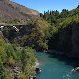
New Zealand Photo Album
It's time to unveil my photo album for our trip to New Zealand. So here it is, I hope you enjoy it. I spent many hours sorting, correcting, captioning and geotagging. I took over 1,700 exposures over 25 days, and condensed it down to 130.
I still have a few rolls of film to develop from my waterproof point-and-shoot camera. Check back soon for those, I will have them digitized and will post them in the above album.
Sadly, I lost my beloved handheld gps unit on the trip, so I had to geotag all the photos manually, and I can't post all of the awesome elevation profiles I hiked.
 |
| New Zealand |
I still have a few rolls of film to develop from my waterproof point-and-shoot camera. Check back soon for those, I will have them digitized and will post them in the above album.
Sadly, I lost my beloved handheld gps unit on the trip, so I had to geotag all the photos manually, and I can't post all of the awesome elevation profiles I hiked.
Sunday, March 14, 2010

Fresh Off the Plane
24 hours of flying. And now I am wide awake (it's 8pm nz time). Time changed tonight for DST in our favor, but for only one hour out of twelve. Do I dare start sorting through the pile of email and photos? No, I would rather blog at the moment. Patience my friends. Photos will come in due time.
The flights went well. All on time, full, friendly. Slept about 8 of the 12 hours of the trans-pacific flight, briefly waking only two times. I am getting good at this?
Before we left Auckland, we attended the Pasifika Festival. Like a state fair, but so much better. Many South Pacific Islands represented with food, singing, dancing, arts, crafts, and other events. Samoa, Tonga, Cook Islands, Fiji, Niue, Tahiti, Tokelau, Tuvalu, Kiribati and the Tangata Whenua (New Zealand Maori). Needs pictures and video to do justice, coming soon. It was great to mingle with the locals, and not stand out so much as tourists (we were all wearing hats and cameras).
I miss New Zealand already, but it is so good to be home. Pet the cats, shower in my own bathroom, sleep in my own quiet comfortable bed....Aaahhh.....
The flights went well. All on time, full, friendly. Slept about 8 of the 12 hours of the trans-pacific flight, briefly waking only two times. I am getting good at this?
Before we left Auckland, we attended the Pasifika Festival. Like a state fair, but so much better. Many South Pacific Islands represented with food, singing, dancing, arts, crafts, and other events. Samoa, Tonga, Cook Islands, Fiji, Niue, Tahiti, Tokelau, Tuvalu, Kiribati and the Tangata Whenua (New Zealand Maori). Needs pictures and video to do justice, coming soon. It was great to mingle with the locals, and not stand out so much as tourists (we were all wearing hats and cameras).
I miss New Zealand already, but it is so good to be home. Pet the cats, shower in my own bathroom, sleep in my own quiet comfortable bed....Aaahhh.....
Friday, March 12, 2010
sad to be leaving nz
sad to be leaving nz in 24 hrs. enjoying Auckland, climbed another volcano today, Pasifika fest tomorrow.
Saturday, March 6, 2010
One week to go.
The last several days have been very long and tiring but fun. After Franz Joseph Glacier we visited Arthur's Pass. I gave Avalance peak a good try but just did not make it, not because of stamina but time restraint (we were given only 6 hours to comlete the hike, and then drive 5 more hours). So I made it about two thirds of the way up, and Tom made it to the top. It was the hardest single-day hike I have ever done, with un-relenting uphill and rock climbing on all fours.
The Kiakoura Coast Track was very nice, a three-day hike through farms with mountain views and on the beach. Saw some sea lions and dolphins. The itenery was only 8 miles per day, and our stuff was shuttled for us, so the hike seemed very easy compaired to the Milford Track.
About halfway through on the first day of the Kiakoura, I was stung by a bee on the inside of my left arm. It hurt quite a bit, and it has been a long time since I was stung and forgot how much it hurt. I slept poorly that night from the itching, and by morning it formed a 4"x2" rash, hot and swollen.
I pushed through the second day of the Kiakoura, careful to protect the rash from the sun, but in a daze from the Benedryl I took to try to control the itching and swelling. By the next morning, the rash was from my armpit to my elbow, and my hand was starting to feel tight and tingly. I was taking the max dose of Benedryl and it seemed to be doing nothing but make me tired.
I had had enough and decided to ask for a ride to the car, and forgo my final day of hiking track. The nice farmers gave us directions to the nearst town of Kiakoura, 45 minutes away. Luckly, Helen-Marie drove me to town since I did not have authoriziation to use the rental car. We had only 2 hours to drive 45 min, see a doctor, get an Rx filled, and get back to pick up the rest of the group.
We found a nice family practice and I explained to the receptionist the situation. Within 15 min I was talking to a doctor, and he wrote me an Rx for Prednezone. He said it had something to do with the fact that it was a foreign bee, which you can react to more easily. Also, the doc gave me the go-ahead to kayak the next day. So we filled the Rx and got back to the rest of the group with 30 min to spare!
The Prednezone helped a lot and within a few hours the redness and itching went down. It is still very sensitive to the sun so I have been wearing long sleves even in the hot times.
Today we went sea kayaking in Tasman Bay in Abel Tasman Natial Park. The weather was sunny and calm, ideal for paddling. Brought back lots of memeries of my wonderful Everglades trip. Tom was my kayak partner and he did well for his first time, with minimal arguing between us.
The 3-hr ferry ride from Picton to Wellington was beautiful through the sounds. Most of the group was passed out on the couches in the lounge of the ship by the end of the ride. Wish I could post pictures for you but I really need to go to bed, it is 2am here! Tomorrow is TePapa Meusum and dinner at Helen-Marie's cousin's house!
The Kiakoura Coast Track was very nice, a three-day hike through farms with mountain views and on the beach. Saw some sea lions and dolphins. The itenery was only 8 miles per day, and our stuff was shuttled for us, so the hike seemed very easy compaired to the Milford Track.
About halfway through on the first day of the Kiakoura, I was stung by a bee on the inside of my left arm. It hurt quite a bit, and it has been a long time since I was stung and forgot how much it hurt. I slept poorly that night from the itching, and by morning it formed a 4"x2" rash, hot and swollen.
I pushed through the second day of the Kiakoura, careful to protect the rash from the sun, but in a daze from the Benedryl I took to try to control the itching and swelling. By the next morning, the rash was from my armpit to my elbow, and my hand was starting to feel tight and tingly. I was taking the max dose of Benedryl and it seemed to be doing nothing but make me tired.
I had had enough and decided to ask for a ride to the car, and forgo my final day of hiking track. The nice farmers gave us directions to the nearst town of Kiakoura, 45 minutes away. Luckly, Helen-Marie drove me to town since I did not have authoriziation to use the rental car. We had only 2 hours to drive 45 min, see a doctor, get an Rx filled, and get back to pick up the rest of the group.
We found a nice family practice and I explained to the receptionist the situation. Within 15 min I was talking to a doctor, and he wrote me an Rx for Prednezone. He said it had something to do with the fact that it was a foreign bee, which you can react to more easily. Also, the doc gave me the go-ahead to kayak the next day. So we filled the Rx and got back to the rest of the group with 30 min to spare!
The Prednezone helped a lot and within a few hours the redness and itching went down. It is still very sensitive to the sun so I have been wearing long sleves even in the hot times.
Today we went sea kayaking in Tasman Bay in Abel Tasman Natial Park. The weather was sunny and calm, ideal for paddling. Brought back lots of memeries of my wonderful Everglades trip. Tom was my kayak partner and he did well for his first time, with minimal arguing between us.
The 3-hr ferry ride from Picton to Wellington was beautiful through the sounds. Most of the group was passed out on the couches in the lounge of the ship by the end of the ride. Wish I could post pictures for you but I really need to go to bed, it is 2am here! Tomorrow is TePapa Meusum and dinner at Helen-Marie's cousin's house!
Sunday, February 28, 2010
Glacier Trecking in Franz Joseph
Just spent the day glacier trecking on the west coast of the south island of New Zealand. It was a short drive and hike to the base of the glacier. From there we strapped on our crampons (ice spikes that attach to your boots) and headed straight up the rocks and ice. Then our guide (Branden) led us through crevaces and tunnels for a total of 1500' elevation ascent. Around lunchtime we sat and had lunch on the glacier tucked away from the wind. After lunch we explored some more of the ice including giant "waves" of ice that towered at least 20' high and wide. The final challenge was down and through a steep and tight crevace measuring about 30' deep and 18" wide (good thing ice is slippery). We used ropes connected to spikes in the ice to walk safely off of the ice back down the glacier valley.
Tomorrow is a 4 hour drive to Arthur's Pass where we'll do a challenging hike the following day (3500' up over 3mi) called Avalanche Peak.
Tomorrow is a 4 hour drive to Arthur's Pass where we'll do a challenging hike the following day (3500' up over 3mi) called Avalanche Peak.
Wednesday, February 24, 2010
First week in NZ
Blogcasting live from Queenstown, NZ, internet cafe. noon here. currently loading pics from D90 to picasa web album, only that sd card is working at the moment. Pics of the Kiwi Bird Park in qt. All pics of backpacking trip were taken with p/s and card is not working now! But the pics seem safe on the card, just won't download, so I won't be able to see them until I get home and can recover them.
Great trip so far. the flights were all on time for our group and set out for Te Anau where we spent the night at a very nice backpackers lodge on the lake. left our cars at the lodge and walked to the ferry that took us north up the lake to the beginning of the Milford Track. Boat ride was georgous and great weathe with mild wind and deep blue skys. The locals drink directly from the lake without treating it and are very proud of it.
First day on the Milford Track was 3 miles through nice hardwood forest with ferns blanketing the ground. All nights stayed in huts with running water! propane cookers and wood fireplace in common area. nice group of mostly europeans hiked with us all 3 days.
Second day on milford was 11 miles, through valley with waterfalls off 2000' cliffs either side. I set out at 7am to beat the crowd and see birds, which I was greatly rewarded. Birds here in the wild are very trusting of people and curious. Don't fly away like they do back home so you can get a good look at them. Tom saw a rare blue duck and got it on video.
Third day was the rain and wind and McKinnon pass was a blistry storm, challenging but fun to conquer (no spell check on the computer!) 1500' up, 3000' down, very steep. Everyone in our group did well and no injuries (can't say the same for the other hikers on the trail that day staying in our hut!). Tom and I did the side hike to Sutherland Falls and it was well worth the trip, the highest falls in NZ. Another 12 miles for this day. Feet are sore by the point but feeling good.
Forth day was the time buster. 11 miles, and needed to catch the ferry from Sandfly point to town of Milford where we had a cruise scheduled around Milford Sound. Rain let up by then, and the hiking was a bit hotter, bugs a bit more bite-e-r, but good day of hiking overall. Set out at 7:30am, and once we were a few miles out we slowed our pace so we would not have to hang out too long at Sandfly Point (aptly named). But it turned out the wind was good at the point and no sandflies. Got our pic taken at the famous 'completion' sign.
Cruise around Milford Sound was nice, wonderful weather, nice to sit for a change and rest your feet while taking in scenery.
Last few days in Queenstown have been relaxing. Tom and I have our own room here in the hostel, primitive but comfortable, quiet with earplugs. Visited the birdpark and saw a kiwi and a lot of other birds I saw on the milford track. Learned about Maori life. Nicely constructed park, well worth the time and money.
Tom is currently on the Shotover Jetboat (I was not interested), I will be exploring the gardens and hiking around the lake here in QT. Tomorrow is Arrowtown, Wanaka, and wine country.
Cheers!
Great trip so far. the flights were all on time for our group and set out for Te Anau where we spent the night at a very nice backpackers lodge on the lake. left our cars at the lodge and walked to the ferry that took us north up the lake to the beginning of the Milford Track. Boat ride was georgous and great weathe with mild wind and deep blue skys. The locals drink directly from the lake without treating it and are very proud of it.
First day on the Milford Track was 3 miles through nice hardwood forest with ferns blanketing the ground. All nights stayed in huts with running water! propane cookers and wood fireplace in common area. nice group of mostly europeans hiked with us all 3 days.
Second day on milford was 11 miles, through valley with waterfalls off 2000' cliffs either side. I set out at 7am to beat the crowd and see birds, which I was greatly rewarded. Birds here in the wild are very trusting of people and curious. Don't fly away like they do back home so you can get a good look at them. Tom saw a rare blue duck and got it on video.
Third day was the rain and wind and McKinnon pass was a blistry storm, challenging but fun to conquer (no spell check on the computer!) 1500' up, 3000' down, very steep. Everyone in our group did well and no injuries (can't say the same for the other hikers on the trail that day staying in our hut!). Tom and I did the side hike to Sutherland Falls and it was well worth the trip, the highest falls in NZ. Another 12 miles for this day. Feet are sore by the point but feeling good.
Forth day was the time buster. 11 miles, and needed to catch the ferry from Sandfly point to town of Milford where we had a cruise scheduled around Milford Sound. Rain let up by then, and the hiking was a bit hotter, bugs a bit more bite-e-r, but good day of hiking overall. Set out at 7:30am, and once we were a few miles out we slowed our pace so we would not have to hang out too long at Sandfly Point (aptly named). But it turned out the wind was good at the point and no sandflies. Got our pic taken at the famous 'completion' sign.
Cruise around Milford Sound was nice, wonderful weather, nice to sit for a change and rest your feet while taking in scenery.
Last few days in Queenstown have been relaxing. Tom and I have our own room here in the hostel, primitive but comfortable, quiet with earplugs. Visited the birdpark and saw a kiwi and a lot of other birds I saw on the milford track. Learned about Maori life. Nicely constructed park, well worth the time and money.
Tom is currently on the Shotover Jetboat (I was not interested), I will be exploring the gardens and hiking around the lake here in QT. Tomorrow is Arrowtown, Wanaka, and wine country.
Cheers!
Tuesday, February 23, 2010
just off milford track. in
just off milford track. in queenstown now. had great time backpacking. only 1 day of rain. nice cruise around milford sound.
Sunday, February 7, 2010
Trip Overview, Part 3
Then we drive 2.5 hours north to the Rotorua area for some strolls to and through volcanic geological formations, taking a dip in a natural hot water pool, and Zorb.
 Then drive 1.5 hours to Tauranga, where we’ll have the option of enjoying a sunset kayaking tour to go see an abundance of glow worms after dark.

The final leg of our trip is Auckland, including a hike on the volcanic island of Rangitoto.


The final leg of our trip is Auckland, including a hike on the volcanic island of Rangitoto.
Trip Overview, Part 2
After the Kiakoura Coast Track, we drive 4.5 north through Marlborough wine region,
 on our way to Marahau, just outside Abel Tasman National Park, where we will be kayaking.

We then take a ferry from the South to the North Island from Picton to Wellington through Cook Strait.

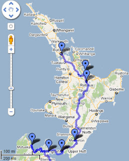
We will be spending a day exploring Wellington, including the Te Papa Museum. Then drive 3 hours north to the west coast of the north island to canoe the Whanganui River.

Then drive 2 hours north to Tongariro National Park stay at a lodge in Whakapapa Village. The Tongariro Crossing hike will be one of our most difficult at 10 miles, ascend 2250 feet, descend 3700 feet, rated the best day tramp by Lonely Planet.


We then take a ferry from the South to the North Island from Picton to Wellington through Cook Strait.
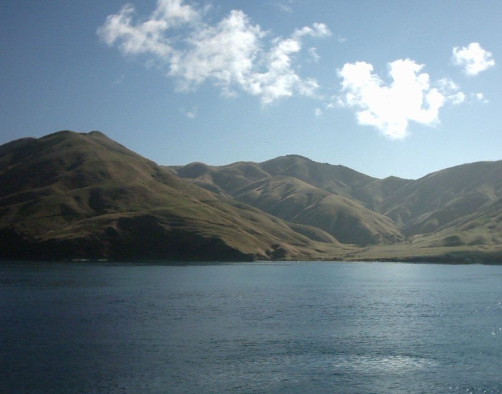

We will be spending a day exploring Wellington, including the Te Papa Museum. Then drive 3 hours north to the west coast of the north island to canoe the Whanganui River.
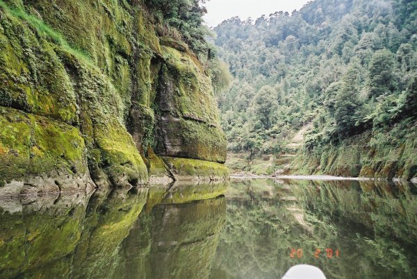
Then drive 2 hours north to Tongariro National Park stay at a lodge in Whakapapa Village. The Tongariro Crossing hike will be one of our most difficult at 10 miles, ascend 2250 feet, descend 3700 feet, rated the best day tramp by Lonely Planet.

Friday, February 5, 2010
Trip Overview, Part 1
Here is an overview of our upcoming adventures in New Zealand.
We are flying from Charlottesville to Charlotte, then to LA. Then a direct flight to Auckland. One last leg will get us to Queenstown on the South Island. That's 24 hours of flying time (30 hours flying+layovers).

Less than 24 hours after landing we will begin the Milford Track, a 4-day, 3-night backpacking trip with hut camping.
Then we will spend three days in Queenstown while our fearless leader solo tramps through the bush. The tentative schedule is first a day of recovery, laundry, and walking around town. I will definitely be visiting the Kiwi Birdlife Park.
The second day in Queenstown will be our 'adventure day,' consisting of jet boating, bungy jumping, via ferrata, or canyoning, to name a few. I just have not decided what I will be doing yet, but Tom wants to go jet boating. The last day will be a quick drive to Arrowtown to explore an old gold mining town with an old Chinese settlement.

The next leg of our trip, after a 5.5 hour drive north will be two days of glacier trekking in Franz Joseph, the worlds steepest and fastest flowing commercially guided glacier. We will hike up to the face of the glacier and explore the ice with crampons.
 A sunset hike around Lake Matheson is also in the plans.

Then we will drive 4 hours north and then east to Arthur's Pass region and (the next day) out-and-back day-hike Avalanche Peak. This will be one of the most scenic hikes, and the steepest at 3600' up in 2 miles (that's a 34% grade!).

Then we will drive 3.5 hours east and then north to hike the Kaikoura Coast Track, a three-day backpacking trip through private farms. We will be staying at farm homes along the way and our stuff will be shuttled for us! So it's not really backpacking, but a series of day hiking adventures. Minimal elevation change compared to previous hikes.

This is just the first half! More info to come!
We are flying from Charlottesville to Charlotte, then to LA. Then a direct flight to Auckland. One last leg will get us to Queenstown on the South Island. That's 24 hours of flying time (30 hours flying+layovers).

Less than 24 hours after landing we will begin the Milford Track, a 4-day, 3-night backpacking trip with hut camping.
Then we will spend three days in Queenstown while our fearless leader solo tramps through the bush. The tentative schedule is first a day of recovery, laundry, and walking around town. I will definitely be visiting the Kiwi Birdlife Park.
The second day in Queenstown will be our 'adventure day,' consisting of jet boating, bungy jumping, via ferrata, or canyoning, to name a few. I just have not decided what I will be doing yet, but Tom wants to go jet boating. The last day will be a quick drive to Arrowtown to explore an old gold mining town with an old Chinese settlement.

The next leg of our trip, after a 5.5 hour drive north will be two days of glacier trekking in Franz Joseph, the worlds steepest and fastest flowing commercially guided glacier. We will hike up to the face of the glacier and explore the ice with crampons.


Then we will drive 4 hours north and then east to Arthur's Pass region and (the next day) out-and-back day-hike Avalanche Peak. This will be one of the most scenic hikes, and the steepest at 3600' up in 2 miles (that's a 34% grade!).

Then we will drive 3.5 hours east and then north to hike the Kaikoura Coast Track, a three-day backpacking trip through private farms. We will be staying at farm homes along the way and our stuff will be shuttled for us! So it's not really backpacking, but a series of day hiking adventures. Minimal elevation change compared to previous hikes.

This is just the first half! More info to come!
I re-evaluated my packing scheme and decided to forgo the suitcase and laptop. I got some 2.5 gallon zipper bags to help organize my clothes in my top-loading backpack. My green pack will be used for day hiking and will go under my car seat when not in use.
Tom will be bringing his day pack (as seen in this photo from last October), and a medium sized duffel bag (that will be checked and will hold some of my things too)
Tom was able to unlock an old Blackberry and bought a SIM card for it that will allow us to make calls from NZ as a local phone. It also has a cool free feature called Travel Journal which will track us in NZ and send emails with our location. It says you can have Facebook track it too.
 |
| From Ramsey's Draft |
 |
| Day pack I am bringing to New Zealand. From Old Rag SNP |
Tom will be bringing his day pack (as seen in this photo from last October), and a medium sized duffel bag (that will be checked and will hold some of my things too)
 |
| From Austin Mt-Furnace Mt Hike SNP |
Tom was able to unlock an old Blackberry and bought a SIM card for it that will allow us to make calls from NZ as a local phone. It also has a cool free feature called Travel Journal which will track us in NZ and send emails with our location. It says you can have Facebook track it too.
Tuesday, February 2, 2010
Is it time to go yet?
Ok, so I'm a little excited to go to New Zealand. So excited I'm already packed, and I still have two weeks till we leave. Crazy, but I feel better now that I am done.  Here is a picture of everything I am bringing. The suitcase is small enough to carry on, but I will be checking it because I will be carrying on the backpack (yes, it looks big but I have done it before). The light green bag is my frameless day-pack that will roll up in the suitcase, and the black camera case I will carry on also.
I am bringing my new D90 and two lenses: 28-200mm f/3.5-5.6 (good light-weight travel lens) and Sigma 10-20mm (for creative stuff). I am also (maybe) bringing my laptop.
From Matt, our trip leader: "If you can manage it, consider packing only enough to do as carry-on / no checked baggage."

 Here is a picture of everything I am bringing. The suitcase is small enough to carry on, but I will be checking it because I will be carrying on the backpack (yes, it looks big but I have done it before). The light green bag is my frameless day-pack that will roll up in the suitcase, and the black camera case I will carry on also.
 I am bringing my new D90 and two lenses: 28-200mm f/3.5-5.6 (good light-weight travel lens) and Sigma 10-20mm (for creative stuff). I am also (maybe) bringing my laptop.
From Matt, our trip leader: "If you can manage it, consider packing only enough to do as carry-on / no checked baggage."

Sunday, January 17, 2010
The Milford Track
Here is an update to my initial post on New Zealand.
The highlight of the trip is our first adventure, the Milford Track. This 4 day hike is the most popular in NZ and is restricted to 90 people starting per day. You have to stay in huts along the track in your reserved day, and there is no camping allowed. Average overnight temperatures will be around 35F while we are there.
Here's a quote from the track brochure:
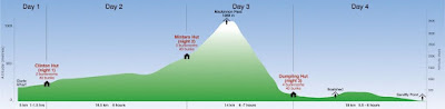
Day 1 - 3 miles, ascend ~150 feet, 1 to 1.5 hour.
Day 2 - 10.3 miles, ascend ~1150 feet, 5 to 6 hours.
Day 3 - 8.7 miles, ascend 1600 feet, descend 3180 feet, 6 to 7 hours; plus 3 (?) mile side trip to Sutherland Falls (1.5 hours) for total ~11.5 or 12 miles, 7.5 to 8.5 hours.
Day 4 - 11.2 miles, descend ~650 feet, 5.5 to 6 hours, catch 2 pm Ferry
Here in our tame Shenandoah mountains, our typical one-day hikes are:
10 miles, ascend 2000', descend 2000', 5 hours
Our typical two-day backpacking trips are:
Day 1: 8 miles, ascend 2000', 5 hours
Day 2: 10 miles, descend 2000', 5 hours
All of my backpacking trips have been two days. I have no idea how my body will deal with 3 and 1/2 days of difficult hiking. Luckily we won't be carrying tents or sleeping bags, so our packs will be lighter than usual. I am really worried about Day 3, a steep decline I have never seen the likes of before. And the last day has a deadline! I just hope that pain and exhaustion will not make me miss the scenery.
Our last major hike was 2 and 1/2 months ago and I am feeling out of shape. Sure, I have been going to the gym but nothing beats the real thing. We have had an unusually cold winter and the trails are treacherous because the snow has not melted yet. If the weather cooperates, we will be out there!

The highlight of the trip is our first adventure, the Milford Track. This 4 day hike is the most popular in NZ and is restricted to 90 people starting per day. You have to stay in huts along the track in your reserved day, and there is no camping allowed. Average overnight temperatures will be around 35F while we are there.
Here's a quote from the track brochure:
Centred at latitude 45o south, Fiordland National Park lies in an area of predominately westerly airstreams, known as the Roaring 40s, delivering high rainfall and changeable weather patterns to the area. Cold temperatures, snow, strong winds and heavy rain can occur at any time of the year.
Day 1 - 3 miles, ascend ~150 feet, 1 to 1.5 hour.
Day 2 - 10.3 miles, ascend ~1150 feet, 5 to 6 hours.
Day 3 - 8.7 miles, ascend 1600 feet, descend 3180 feet, 6 to 7 hours; plus 3 (?) mile side trip to Sutherland Falls (1.5 hours) for total ~11.5 or 12 miles, 7.5 to 8.5 hours.
Day 4 - 11.2 miles, descend ~650 feet, 5.5 to 6 hours, catch 2 pm Ferry
Here in our tame Shenandoah mountains, our typical one-day hikes are:
10 miles, ascend 2000', descend 2000', 5 hours
Our typical two-day backpacking trips are:
Day 1: 8 miles, ascend 2000', 5 hours
Day 2: 10 miles, descend 2000', 5 hours
All of my backpacking trips have been two days. I have no idea how my body will deal with 3 and 1/2 days of difficult hiking. Luckily we won't be carrying tents or sleeping bags, so our packs will be lighter than usual. I am really worried about Day 3, a steep decline I have never seen the likes of before. And the last day has a deadline! I just hope that pain and exhaustion will not make me miss the scenery.
Our last major hike was 2 and 1/2 months ago and I am feeling out of shape. Sure, I have been going to the gym but nothing beats the real thing. We have had an unusually cold winter and the trails are treacherous because the snow has not melted yet. If the weather cooperates, we will be out there!
Wednesday, November 11, 2009
Hiking Training Progress Report
We have about 100 days until the trip and have been working hard at improving my stamina for long distance hiking. In the past 3 months we have hiked about 120 miles, with about 32,600 feet of elevation up and down over 10 day hikes and two backpacking trips. When I first started, my average day hike speed was 1.4 mph, and now I average 2 mph. I have been keeping track of everything using my GPS.
I have lost 10 pounds and gained a lot of muscle. Hiking is more enjoyable and I feel more confident and less clumsy. But I still have a ways to go with overall speed, especially with a pack. I have to get up to 2.5 mph to match the leader's low speed.
I have lost 10 pounds and gained a lot of muscle. Hiking is more enjoyable and I feel more confident and less clumsy. But I still have a ways to go with overall speed, especially with a pack. I have to get up to 2.5 mph to match the leader's low speed.
Monday, November 2, 2009
Tom and I have been "training" for the New Zealand trip by hiking a lot. Sometimes just the two of us, sometimes with a group. When it was still hot out we led our own trips because it was harder to find people to hike with because of the heat. But I found that it was not too bad if you plan it right. Choose trails with good tree cover and hike down ridges that are in shadow during the time of the day of your hike (for example, hike down the western slope of the SNP in the morning). A bug net for your face is a must for summertime hiking too.
Now that the weather is good and the trees are pretty, there is no shortage of hiking companions. Saturday we went hiking with the OASC/PATC in the SNP and there was about 12 of us. Most of the leaves had fallen off the trees in the lower elevations, and the upper elevations had about a quarter of the leaves left. Only oaks and beech leaves remain on trees. I think that the general population does not realize that peak color in the mountains is about 2-3 weeks before the valley. Tom and I have been enjoying fall color at various elevations for almost 8 weeks.
Last weekend's hike was from the Pinnacles Overlook, along Whiterocks ridge and along Hazel River. The first and last miles were not fun due to the steepness of the trail and poor footing from the fresh wet leaves. Overwise the hike was very nice. The weather was very warm (70s in the valley) and humid with some sprinkles at the end (I hiked in a t-shirt and shorts). We ate lunch next to nice waterfall that was flowing well due to the recent rain. There were some nice old growth trees along the Hazel River Trail, and I found a poplar leaf on the ground measuring over 10 inches wide.
I don't have any pictures for you yet, but here are is the gps info. We hiked 10 miles, climbed about 2000' at an average speed of 1.8 mph.
Now that the weather is good and the trees are pretty, there is no shortage of hiking companions. Saturday we went hiking with the OASC/PATC in the SNP and there was about 12 of us. Most of the leaves had fallen off the trees in the lower elevations, and the upper elevations had about a quarter of the leaves left. Only oaks and beech leaves remain on trees. I think that the general population does not realize that peak color in the mountains is about 2-3 weeks before the valley. Tom and I have been enjoying fall color at various elevations for almost 8 weeks.
Last weekend's hike was from the Pinnacles Overlook, along Whiterocks ridge and along Hazel River. The first and last miles were not fun due to the steepness of the trail and poor footing from the fresh wet leaves. Overwise the hike was very nice. The weather was very warm (70s in the valley) and humid with some sprinkles at the end (I hiked in a t-shirt and shorts). We ate lunch next to nice waterfall that was flowing well due to the recent rain. There were some nice old growth trees along the Hazel River Trail, and I found a poplar leaf on the ground measuring over 10 inches wide.
I don't have any pictures for you yet, but here are is the gps info. We hiked 10 miles, climbed about 2000' at an average speed of 1.8 mph.
 |
| From Hazel Mt-Whiterocks SNP |
 |
| From Hazel Mt-Whiterocks SNP |
Monday, October 12, 2009
Fun With GPS
I love maps. Maps of all types. Historical, political, nautical, fantasy (my favorite is Middle Earth), and especially topographical. And when you mix maps with an portable electronic gadget you have a recipe for fun.
Tom thinks I am crazy for wanting to document every location of every picture I ever take. But I like recording this sort of info especially when we are in the wilderness or traveling. For the longest time I was geotagging manually. This is the process of using a program like Google Earth to point to the spot where you know (or guess) the picture was taken, and then the software records the latitude and longitude coordinates on the exif metadata tags.
Don't get me wrong. Google Earth is great, but the process of geotagging is slow. There are more simple programs out there, but I was still running into the problem of not knowing or remembering the exact location of the photo. And after a ten-day trip, this can be impossible.
That's when I started looking into real-time geotagging devices for my camera. But they are expensive and camera specific (and I would probably need to upgrade my camera). For the same price range you can get a unit with topo maps, bells, and whistles too.
The trick for me was to find out how to use the gps unit to automatically geotag my pictures. Automatic is the key, considering I take about 1000 exposures on a 1-week trip. It took quite a bit of hunting around on the internet and experimenting with my unit before I came up with the solution.
The key to automatically geotagging your photos is simple - time and date stamp. Every camera records the time and date taken, according to what you set of course. It is stored in the metadata tags, an invisible universal packet of info that comes with each photo.
So I knew that all I needed was a gps unit that could record my movement in a file with date, time, and location, and the ability to download the data at the end of the trip. In the gps world, this is called a track, and the universal file format is gpx. It turns out that almost all modern gps units will do this.
The next step was to find software (preferable free) to read the gpx track file, interpolate where necessary, and write the metadata tags automatically. Surprisingly, Microsoft Pro Photo Tools easily does just that. It will also allow you to change the time/date stamp if your camera was accidentally set wrong. To make things easy, you just make sure the gps and camera are set to approximately the same time.
I purchased a simple Garmin etrex Venture HC. It will save 10,000 track points, and a typical hike takes about 2,000 (you can change the resolution setting). I wish I had spent a little more money (well an extra $100) on a unit that has an optional removable SD memory card (my unit has only 24k) so I could go longer without downloading (I don't typically travel with my laptop). I also got the US Topo Maps.

I plan to track every minute of my trip to New Zealand. Matt said I could use his laptop to download data when needed. I don't have New Zealand maps yet, but I found a NZ Road Map opensource project that looks promising.
Tom thinks I am crazy for wanting to document every location of every picture I ever take. But I like recording this sort of info especially when we are in the wilderness or traveling. For the longest time I was geotagging manually. This is the process of using a program like Google Earth to point to the spot where you know (or guess) the picture was taken, and then the software records the latitude and longitude coordinates on the exif metadata tags.
Don't get me wrong. Google Earth is great, but the process of geotagging is slow. There are more simple programs out there, but I was still running into the problem of not knowing or remembering the exact location of the photo. And after a ten-day trip, this can be impossible.
That's when I started looking into real-time geotagging devices for my camera. But they are expensive and camera specific (and I would probably need to upgrade my camera). For the same price range you can get a unit with topo maps, bells, and whistles too.
The trick for me was to find out how to use the gps unit to automatically geotag my pictures. Automatic is the key, considering I take about 1000 exposures on a 1-week trip. It took quite a bit of hunting around on the internet and experimenting with my unit before I came up with the solution.
The key to automatically geotagging your photos is simple - time and date stamp. Every camera records the time and date taken, according to what you set of course. It is stored in the metadata tags, an invisible universal packet of info that comes with each photo.
So I knew that all I needed was a gps unit that could record my movement in a file with date, time, and location, and the ability to download the data at the end of the trip. In the gps world, this is called a track, and the universal file format is gpx. It turns out that almost all modern gps units will do this.
 |
| From Rocky-Brown Mountain Hike SNP |
The next step was to find software (preferable free) to read the gpx track file, interpolate where necessary, and write the metadata tags automatically. Surprisingly, Microsoft Pro Photo Tools easily does just that. It will also allow you to change the time/date stamp if your camera was accidentally set wrong. To make things easy, you just make sure the gps and camera are set to approximately the same time.
 |
| From Rocky-Brown Mountain Hike SNP |
I purchased a simple Garmin etrex Venture HC. It will save 10,000 track points, and a typical hike takes about 2,000 (you can change the resolution setting). I wish I had spent a little more money (well an extra $100) on a unit that has an optional removable SD memory card (my unit has only 24k) so I could go longer without downloading (I don't typically travel with my laptop). I also got the US Topo Maps.
I plan to track every minute of my trip to New Zealand. Matt said I could use his laptop to download data when needed. I don't have New Zealand maps yet, but I found a NZ Road Map opensource project that looks promising.
Wednesday, October 7, 2009
NZ Prep Time
A friend asked that I blog more about my trip to New Zealand, so here it is, not to entice jealousy, but to share my excitement.
The 25-day trip itinerary is very full, with 13 days of hiking, 3 days of canoe/sea kayaking, 3 ferry rides, and over 35 hours of driving. Much of the hiking is over steep and rough terrain. Tom and I have been hiking almost every weekend for the last several months to prepare for this aspect of the trip. It seems that since my back injury my feet became soft and my legs complacent. My goal is to be able to hike 12 miles with an elevation change of 3000' in less than 8 hours with a 20 pound pack. Tom is a very good hiker and I have no worries about him being able to complete all of the NZ hikes, and I am about half way to my conditioning goal. My other goal to make NZ more enjoyable is to drop another 15 pounds. I will keep you updated on my hiking and weight goals. To see the hikes completed so far, see my web album.
We will have three free days in Queenstown, the adventure capital of the world, so I will be blogging about what to do here.
Another aspect of trip preparation is shopping. We won't have much room for our stuff, but the urge to go wild is overwhelming. "But it's a once in a life-time trip, and I need it." Well, luckily (or not), my wonderful husband has great restraint. My biggest shopping element is hiking boots, which I will talk more about later.
Stay tuned.
The 25-day trip itinerary is very full, with 13 days of hiking, 3 days of canoe/sea kayaking, 3 ferry rides, and over 35 hours of driving. Much of the hiking is over steep and rough terrain. Tom and I have been hiking almost every weekend for the last several months to prepare for this aspect of the trip. It seems that since my back injury my feet became soft and my legs complacent. My goal is to be able to hike 12 miles with an elevation change of 3000' in less than 8 hours with a 20 pound pack. Tom is a very good hiker and I have no worries about him being able to complete all of the NZ hikes, and I am about half way to my conditioning goal. My other goal to make NZ more enjoyable is to drop another 15 pounds. I will keep you updated on my hiking and weight goals. To see the hikes completed so far, see my web album.
We will have three free days in Queenstown, the adventure capital of the world, so I will be blogging about what to do here.
Another aspect of trip preparation is shopping. We won't have much room for our stuff, but the urge to go wild is overwhelming. "But it's a once in a life-time trip, and I need it." Well, luckily (or not), my wonderful husband has great restraint. My biggest shopping element is hiking boots, which I will talk more about later.
Stay tuned.
Friday, August 7, 2009
Travel Blog Coming Soon.
Tom and I got back from our trip Monday, but since then we have been be very busy. I have been spending my spare time working on the 1000+ photos we took. I have also re-immersed myself completely in working out. The hiking on this trip made me realize how out of shape I am, and how much I need to improve before our trip to New Zealand. That also means losing 25 pounds in 25 weeks, which is quite doable, trips to the gym almost every day, and hiking every weekend.
Check back soon for my travel blog. I journaled every day of the trip, so you will all get accurate first-hand accounts of our activities. Unlike my everglades trip where I tried to make a blog post of every day of the trip, I will be splitting it up into one blog per section: Grand Tetons, Yellowstone, and Craters of the Moon.
In the mean time, please check out all of my hard work at my web album for photos. Add comments too. If you have a google account, please add me as a "favorite." This is done by clicking on "Add to Favorites" in the top of the right column under "Photos by Jennifer." If you do this I will feel like a million bucks with a fan base, and you can get updates when I add new photos.
Check back soon for my travel blog. I journaled every day of the trip, so you will all get accurate first-hand accounts of our activities. Unlike my everglades trip where I tried to make a blog post of every day of the trip, I will be splitting it up into one blog per section: Grand Tetons, Yellowstone, and Craters of the Moon.
In the mean time, please check out all of my hard work at my web album for photos. Add comments too. If you have a google account, please add me as a "favorite." This is done by clicking on "Add to Favorites" in the top of the right column under "Photos by Jennifer." If you do this I will feel like a million bucks with a fan base, and you can get updates when I add new photos.
Subscribe to:
Posts (Atom)